Weida (White Elster)
This article needs additional citations for verification. (February 2024) |
| Weida | |
|---|---|
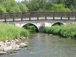
 The Weida in Lawitz | |
| Location | |
| Country | Germany |
| State | Thuringia |
| Physical characteristics | |
| Source | |
| • location | near Pausa |
| • elevation | 500 m (1,600 ft) |
| Mouth | |
• location | White Elster |
• coordinates | 50°47′44″N 12°5′21″E / 50.79556°N 12.08917°E |
| Length | 57 km (35 mi) |
| Basin features | |
| Progression | White Elster→ Saale→ Elbe→ North Sea |
The Weida (German: [ˈvaɪdaː] ) is a non-navigable river in eastern Thuringia, Germany,[1] left tributary of the White Elster. Most of its course is situated in the district of Greiz.
The Weida's source is near Pausa in Saxony; it then flows through the Thuringian Highland passing Zeulenroda-Triebes and through the eponymous Weida. It then feeds into the White Elster near Wünschendorf/Elster. Its tributaries include the Auma and the Leuba.
References
- ^ Schwientek, Marc; Osenbrück, Karsten; Fleischer, Matthias (2013). "Investigating hydrological drivers of nitrate export dynamics in two agricultural catchments in Germany using high-frequency data series". Environmental Earth Sciences. 69 (2): 381–393. doi:10.1007/s12665-013-2322-2.
